One island, sea to summit
An independent guide to Madeira — the levada walks threaded along the cliffs, the laurel forest in the mist, the peaks that stand above the clouds, and the volcanic coast below. Walked end to end, written plainly, nothing sponsored.
Plan your island
3 guidesHow to see Madeira without wasting the few days you have: by hire car, on foot along the channels, or on one of the Madeira tours that run out of Funchal. Start here.
 Madeira tours: how to see the island
Guided jeep and levada tours, boat trips and sunrise runs, set against the case for a hire car — what's worth a guide and what isn't.
Madeira tours: how to see the island
Guided jeep and levada tours, boat trips and sunrise runs, set against the case for a hire car — what's worth a guide and what isn't.
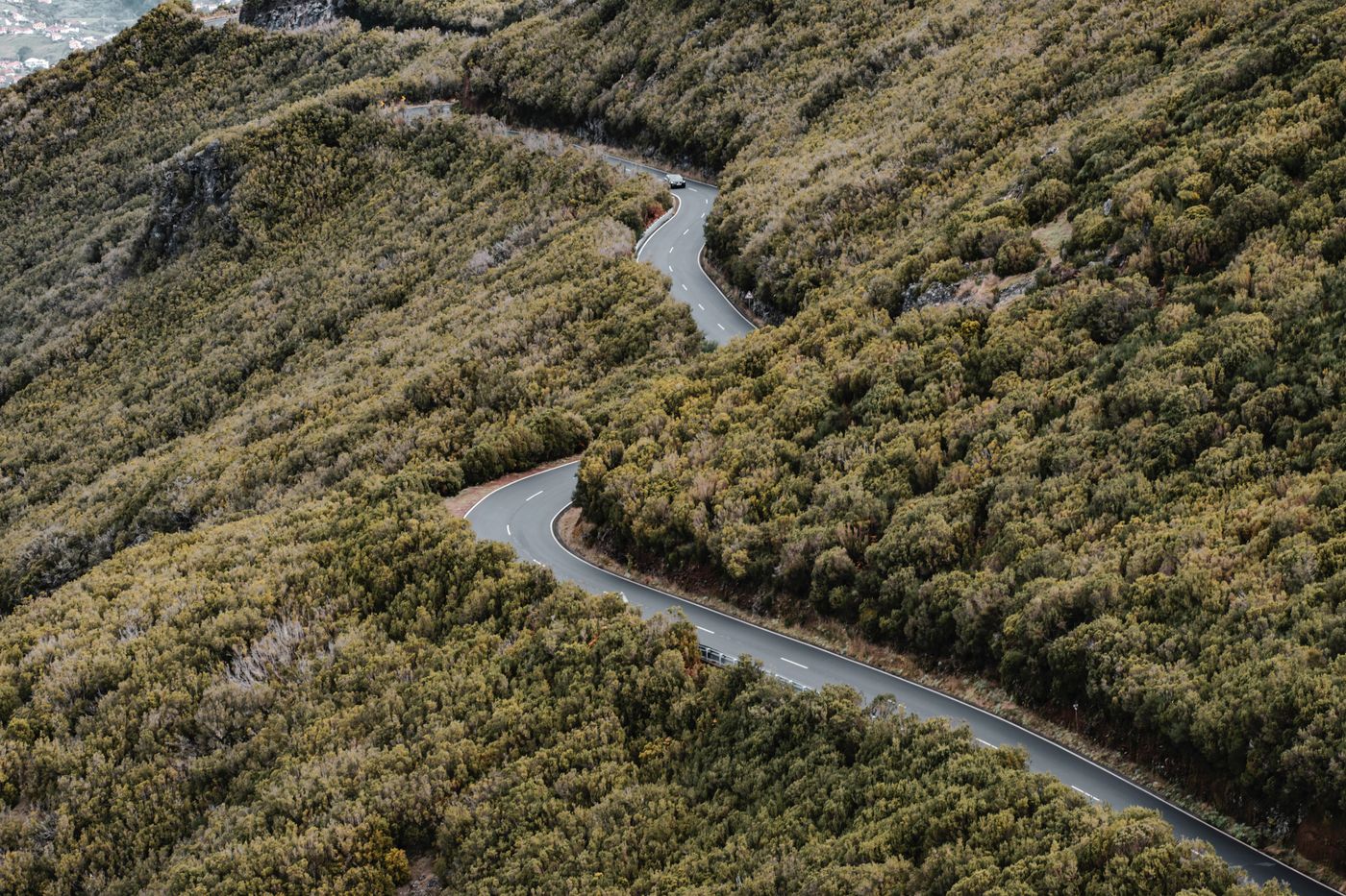
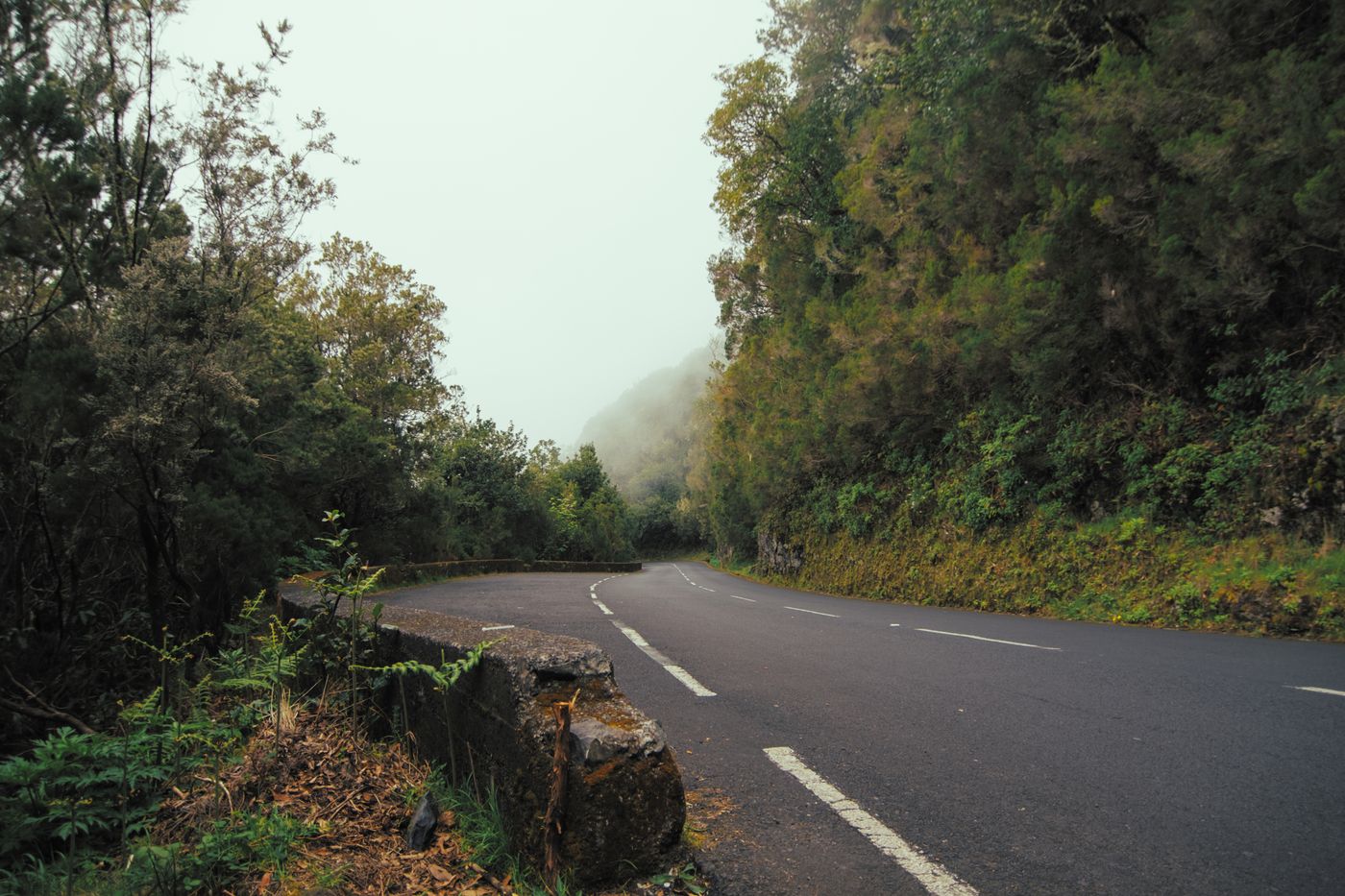 Getting around, and when to go
Hire car, buses or tours; the tunnels and the hairpin roads; and which season suits the walking, the swimming and the flowers.
Getting around, and when to go
Hire car, buses or tours; the tunnels and the hairpin roads; and which season suits the walking, the swimming and the flowers.
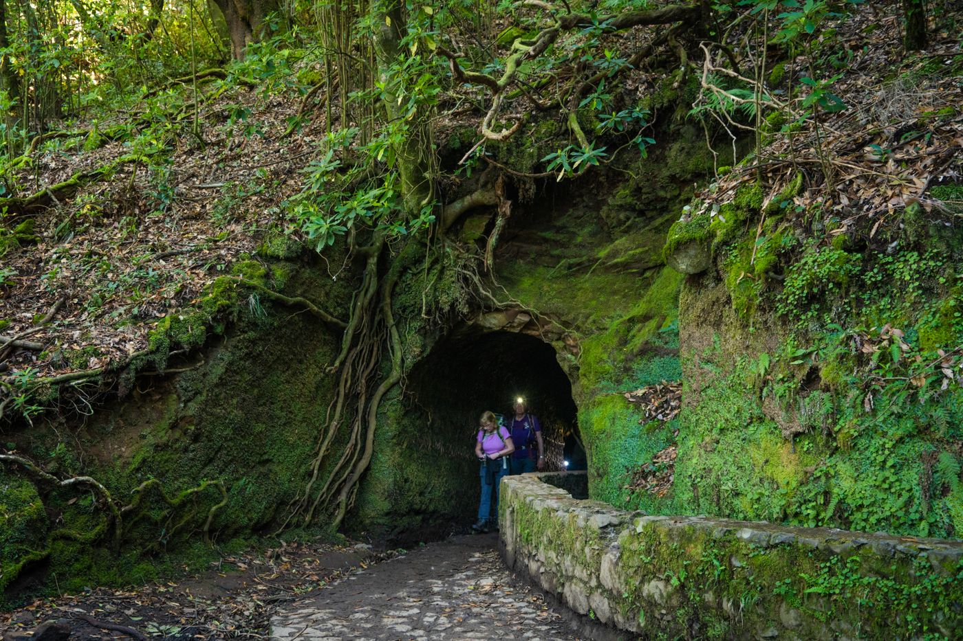 The levadas, explained
How a 17th-century irrigation network became the world's strangest walking system — and how to read a levada walk before you set off.
The levadas, explained
How a 17th-century irrigation network became the world's strangest walking system — and how to read a levada walk before you set off.
Funchal
3 guidesThe capital climbs from the harbour into the hills. A working southern city of markets, gardens and a cable car — and the base most visitors keep.
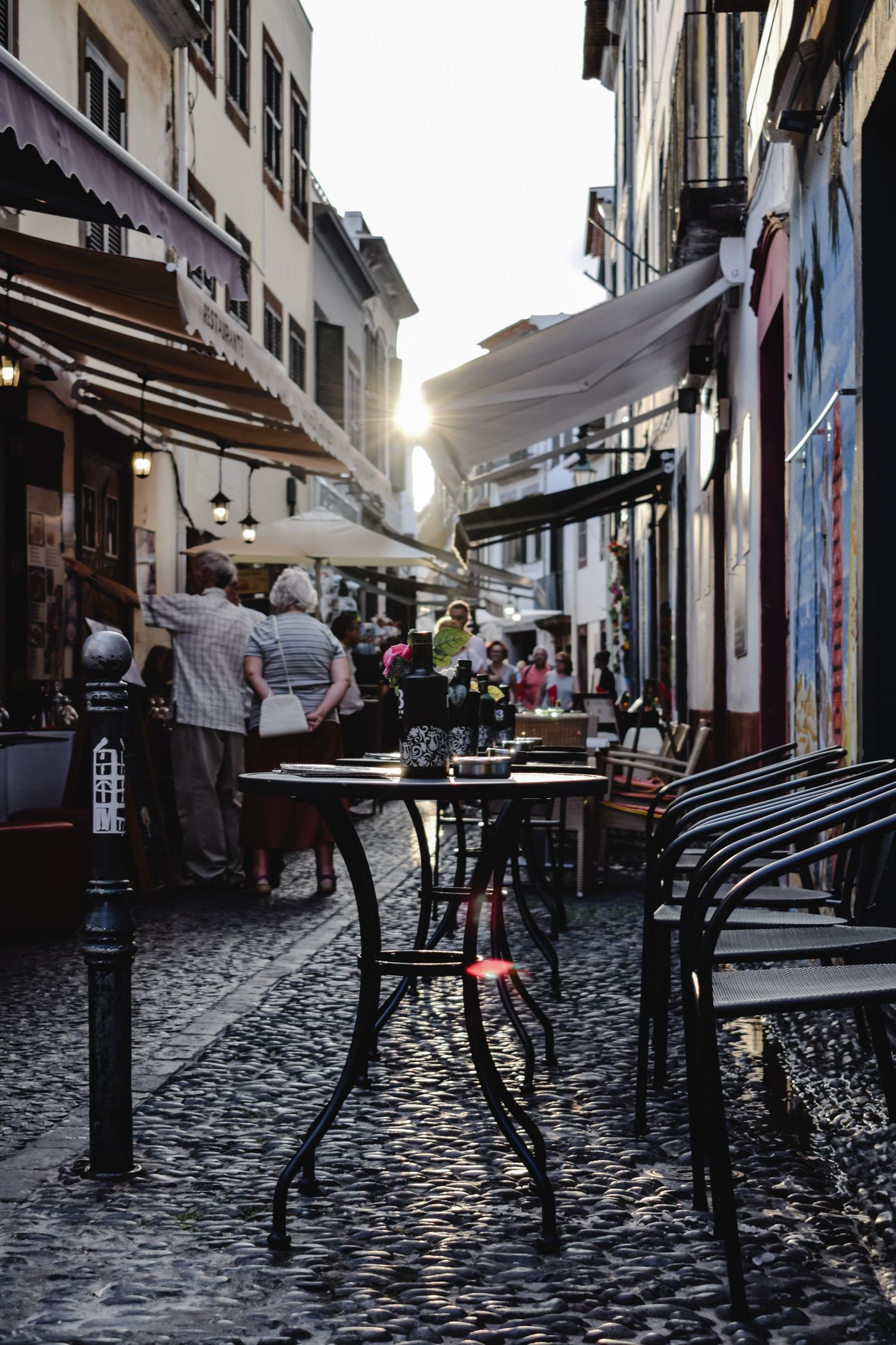 Funchal's old town and market
The Zona Velha's painted doors, the Mercado dos Lavradores, and a capital that rewards a slow morning on foot.
Funchal's old town and market
The Zona Velha's painted doors, the Mercado dos Lavradores, and a capital that rewards a slow morning on foot.
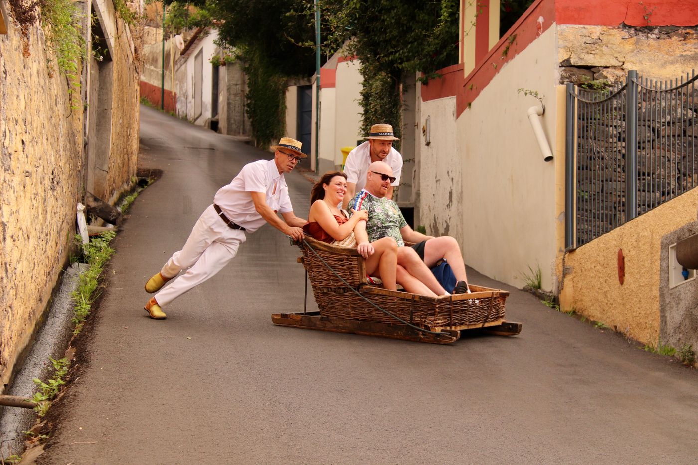 Monte and the toboggan
Up by cable car to the gardens and the church, then down the hill in a wicker sledge steered by two men in straw hats.
Monte and the toboggan
Up by cable car to the gardens and the church, then down the hill in a wicker sledge steered by two men in straw hats.
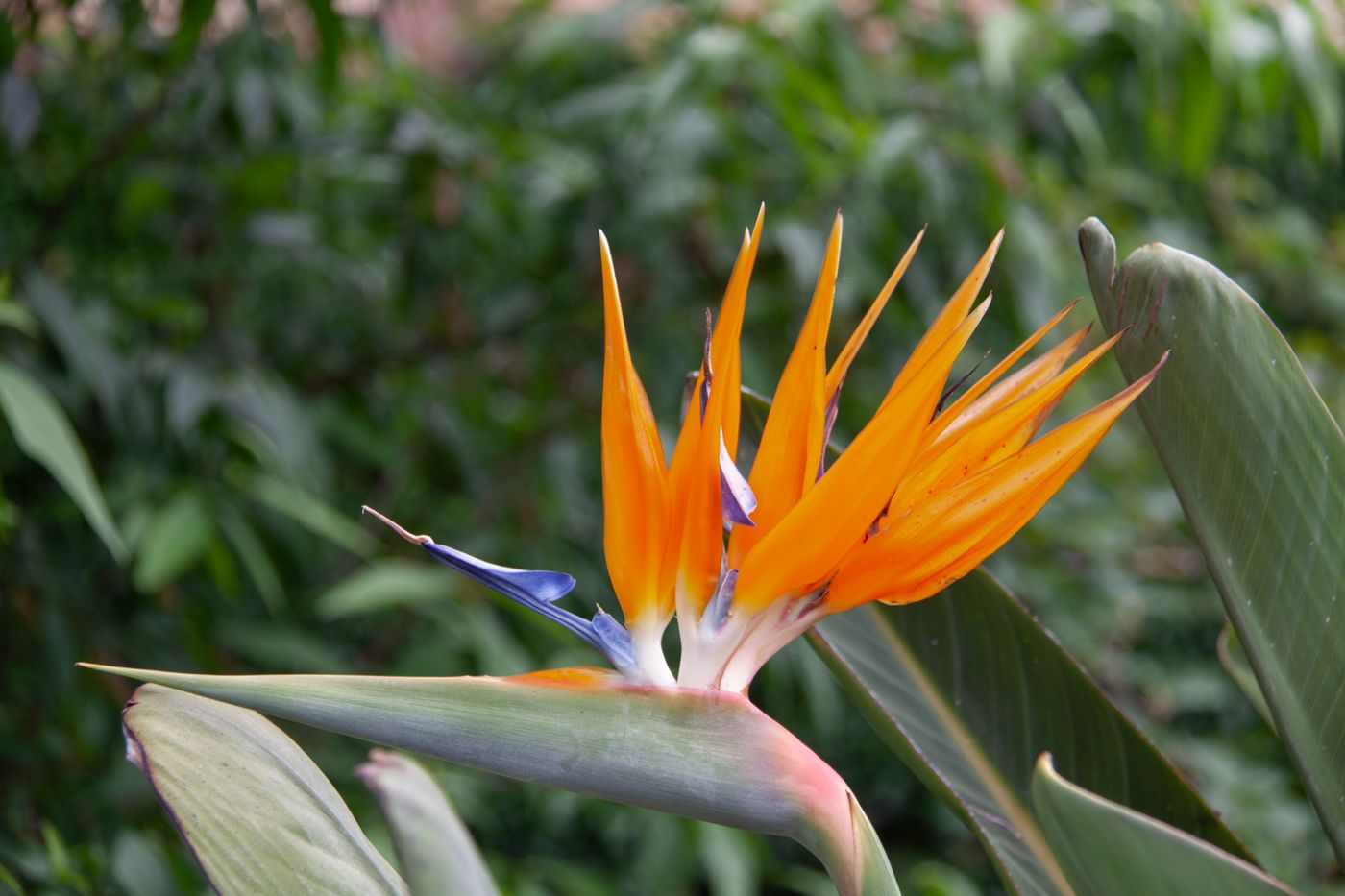 The gardens above the bay
Terraced botanical gardens of birds of paradise and dragon trees, and the cable car that floats you over the valley to reach them.
The gardens above the bay
Terraced botanical gardens of birds of paradise and dragon trees, and the cable car that floats you over the valley to reach them.
Mountains & trails
4 guidesThe interior is the reason to come. Peaks above the clouds, a UNESCO laurel forest, and the cliff-hugging channels that carry water — and walkers — across the island.
 Pico do Arieiro to Pico Ruivo
Madeira's great ridge walk, from the third-highest peak to the highest, often above a sea of cloud. The island's finest day on foot.
Pico do Arieiro to Pico Ruivo
Madeira's great ridge walk, from the third-highest peak to the highest, often above a sea of cloud. The island's finest day on foot.
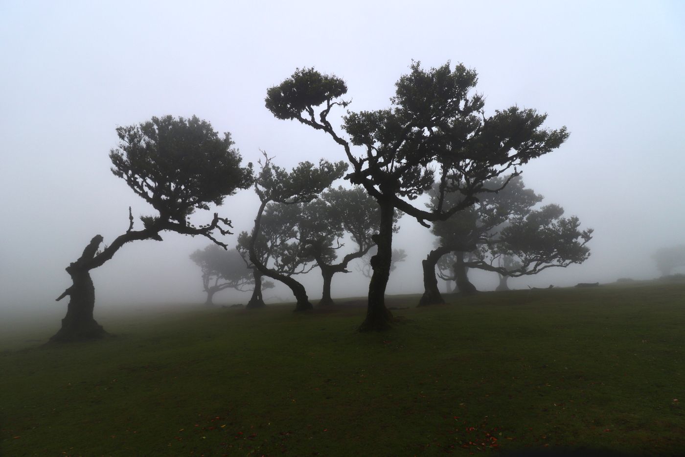 The laurel forest and Fanal
A UNESCO relic of the forest that once covered southern Europe — and the ghostly, mist-wrapped trees of Fanal.
The laurel forest and Fanal
A UNESCO relic of the forest that once covered southern Europe — and the ghostly, mist-wrapped trees of Fanal.
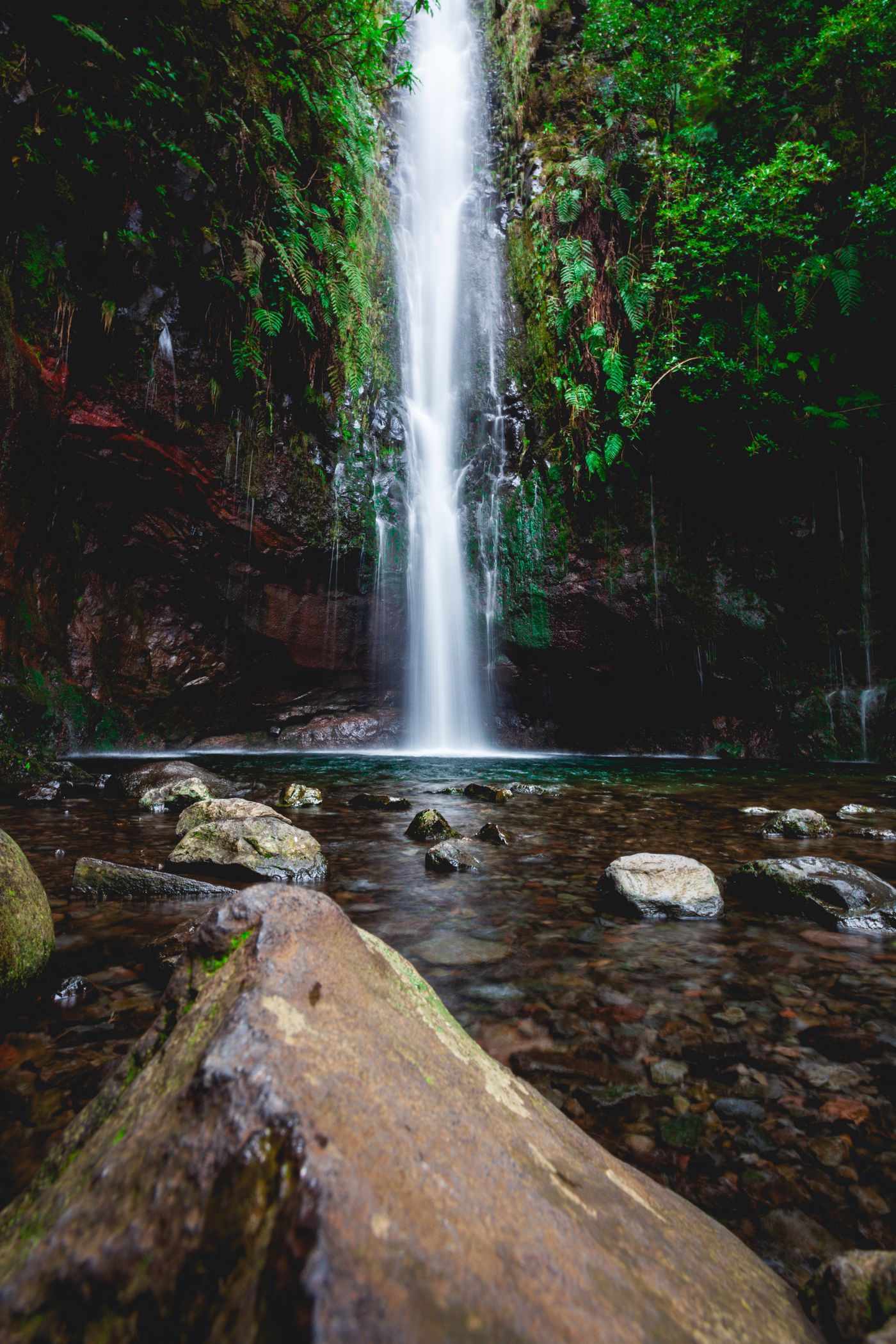
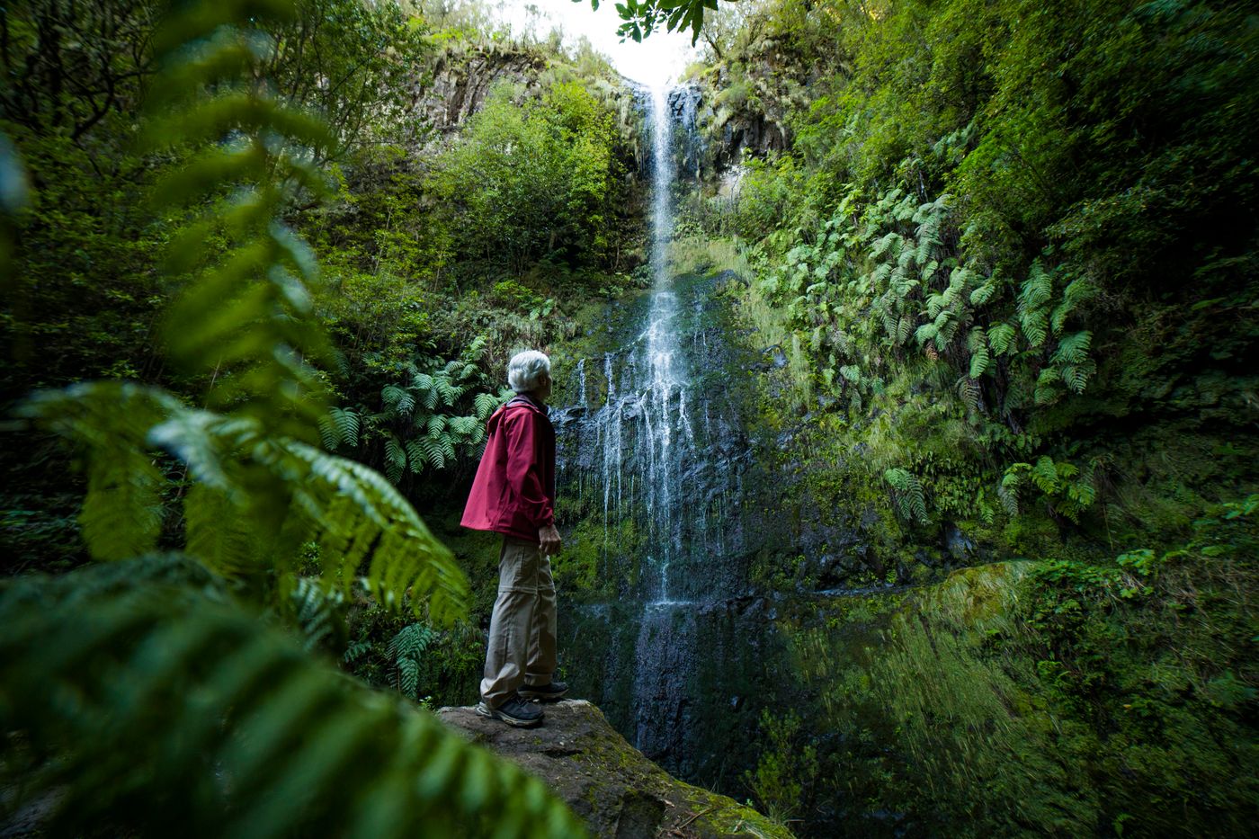 Levada do Caldeirão Verde
A near-level walk through hand-cut tunnels and along a cliff-hugging channel to a waterfall in a green cauldron.
Levada do Caldeirão Verde
A near-level walk through hand-cut tunnels and along a cliff-hugging channel to a waterfall in a green cauldron.
 25 Fontes and Rabaçal
Down into the Rabaçal valley to the Twenty-Five Fountains — the island's most popular levada walk, for good reason.
25 Fontes and Rabaçal
Down into the Rabaçal valley to the Twenty-Five Fountains — the island's most popular levada walk, for good reason.
Coast & table
4 guidesWhere the volcano meets the Atlantic: sea-cliffs and lava pools, a fishing village, the bare red east — and what ends up on the plate at the end of the day.
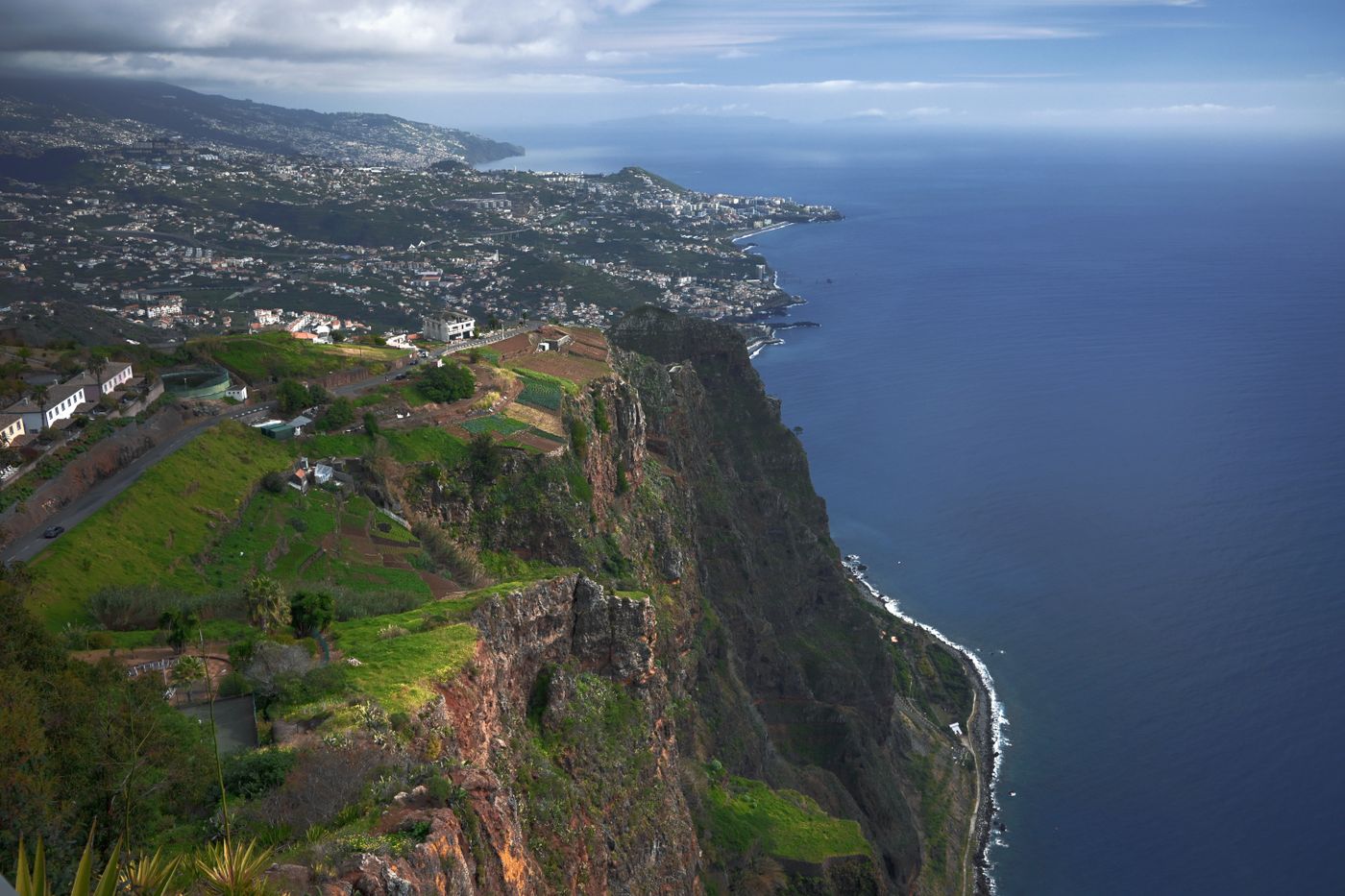 Cabo Girão and Câmara de Lobos
Europe's highest sea-cliff skywalk, and the fishing village below it where the poncha is poured strong.
Cabo Girão and Câmara de Lobos
Europe's highest sea-cliff skywalk, and the fishing village below it where the poncha is poured strong.
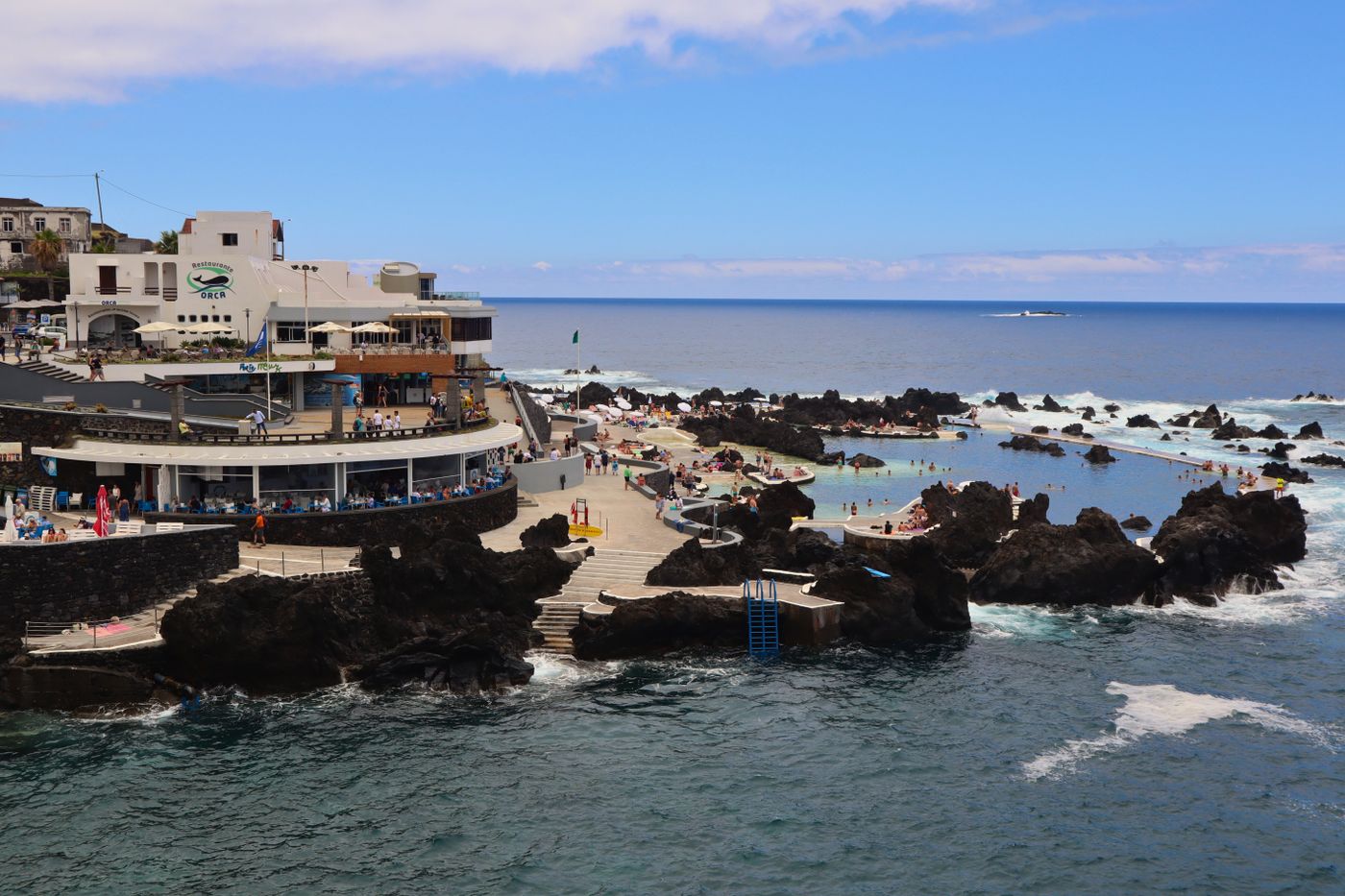 Porto Moniz and the northwest
Volcanic rock pools fed by the Atlantic swell, the green amphitheatre of Seixal, and the wild north-coast road.
Porto Moniz and the northwest
Volcanic rock pools fed by the Atlantic swell, the green amphitheatre of Seixal, and the wild north-coast road.
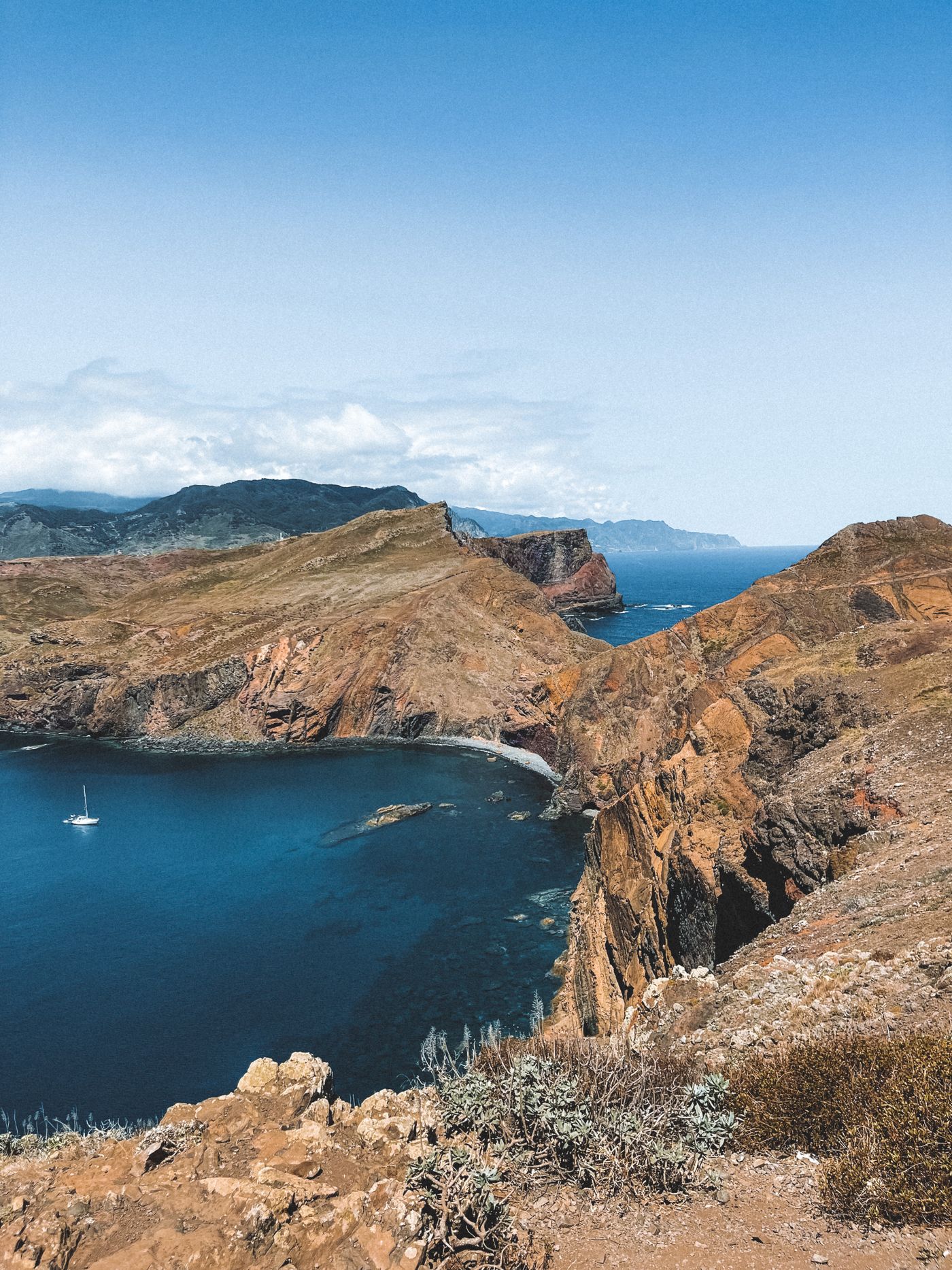 Ponta de São Lourenço
The island's red-rock tail: a treeless, wind-scoured peninsula that looks nothing like the green west.
Ponta de São Lourenço
The island's red-rock tail: a treeless, wind-scoured peninsula that looks nothing like the green west.
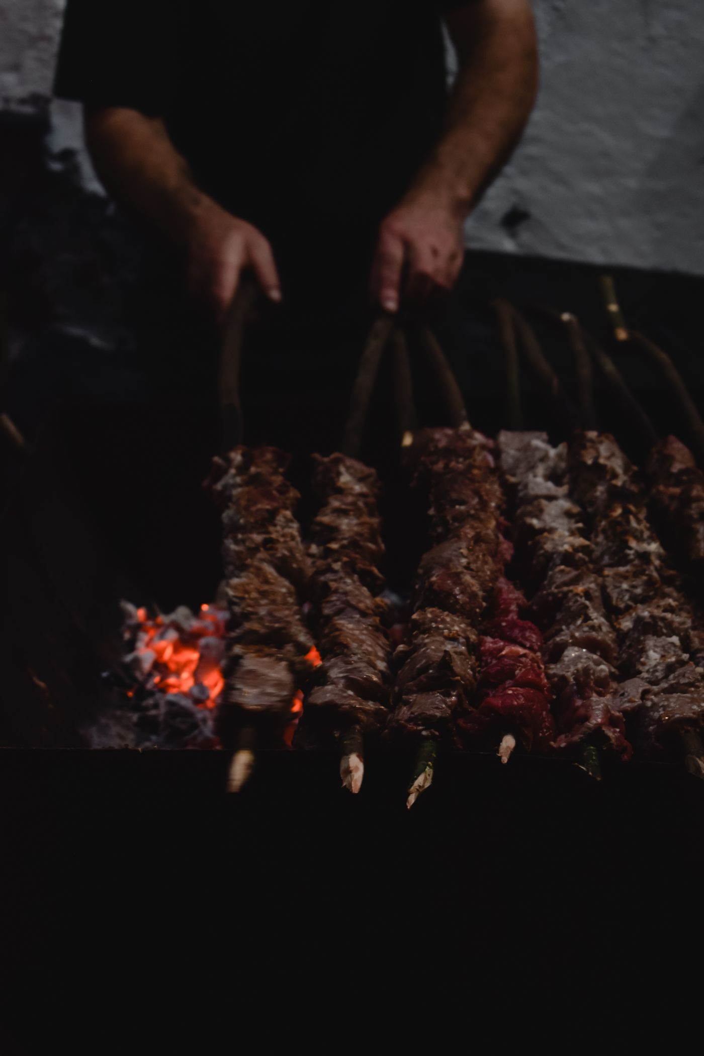 The Madeira table
Espetada on bay-laurel skewers, bolo do caco, black scabbard with banana, and the fortified wine that survived a sea voyage.
The Madeira table
Espetada on bay-laurel skewers, bolo do caco, black scabbard with banana, and the fortified wine that survived a sea voyage.