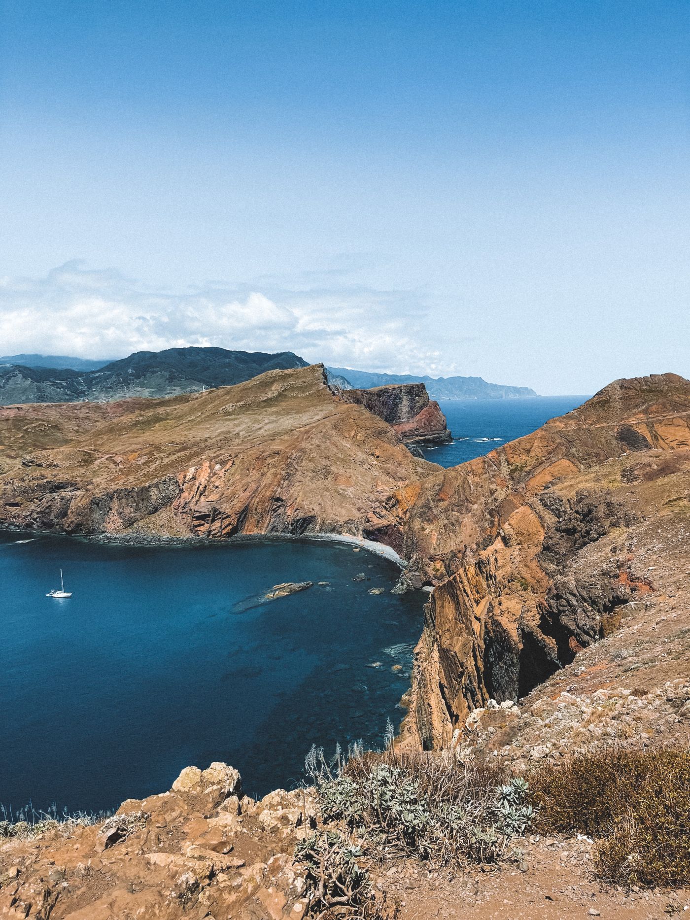
The peninsula seen from the first climb above Baía d'Abra. No trees, two seas, and a ridge that keeps going.
Coast · sea level
Ponta de São Lourenço
Walk east on Madeira long enough and the island gives up on being green. The forest thins, the laurels stop, and the land narrows into a red, treeless tail with the Atlantic pressing in from both sides. This is the clearest place to see the two halves of the island at once.
Most of Madeira is a wet, dark-green mountain. You spend a few days under dripping laurel canopy, beside levadas thick with fern, looking at cloud snagged on the peaks, and you start to think the whole island is built that way. Then you drive to the far eastern end, park at Baía d'Abra, and walk fifteen minutes onto something that looks like it was carved from a different planet.
Ponta de São Lourenço is the easternmost point of the island. It is a long, thin peninsula of volcanic rock, almost entirely bare, banded in rust-red, ochre and pale grey, with sea on the north and sea on the south and not much width in between. There are no trees out here. There is barely any shade. On most days there is a lot of wind.
Why it is red, and why it is dry
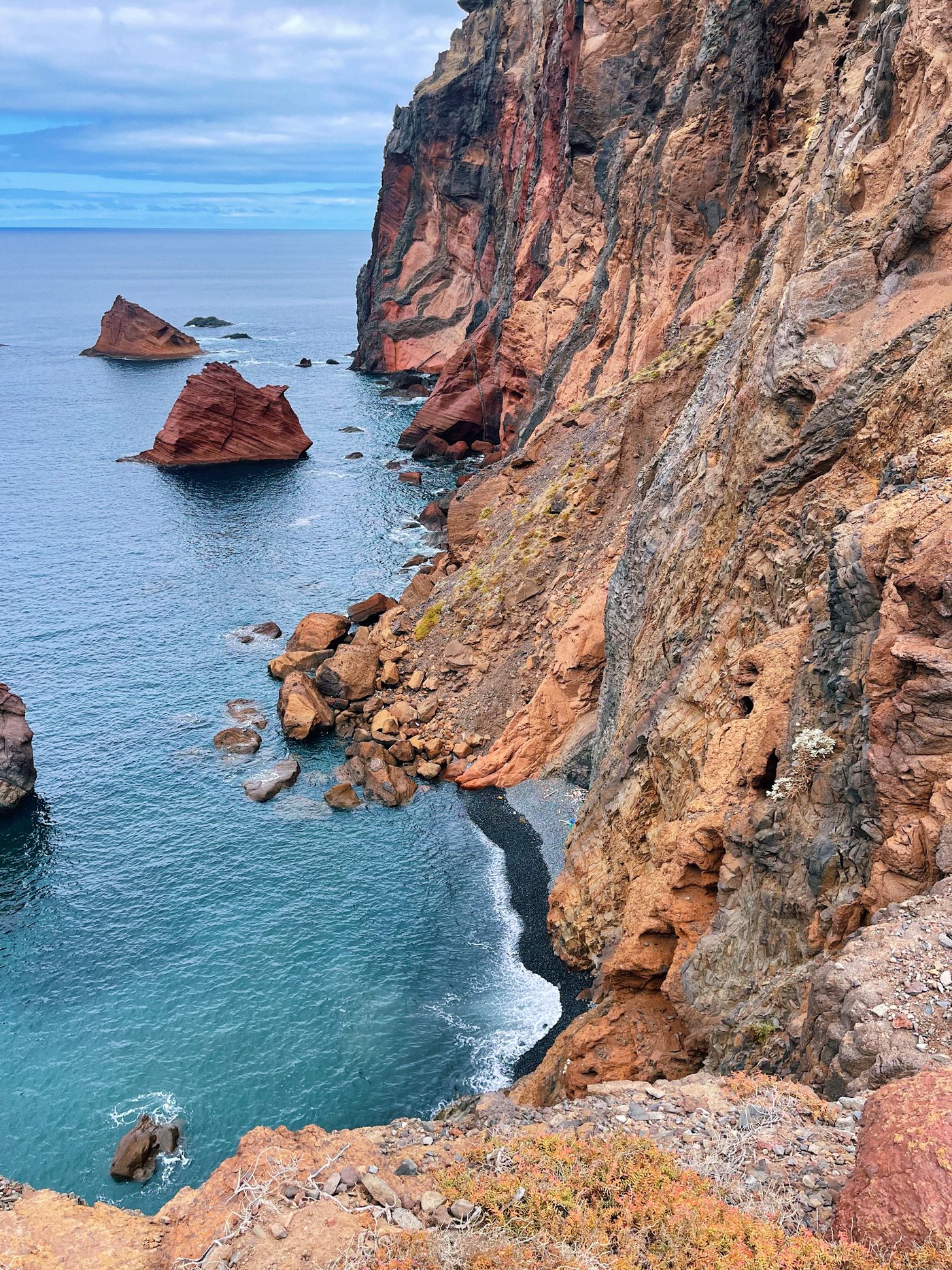
The rock is the honest answer. This peninsula is volcanic in origin, mostly basalt with some softer sediment layers, and the iron in it has oxidised over a very long time. Those warm reds and oranges you see in the cliffs are, in plain terms, rust. These formations are old even by Madeira's standards, and the sea has been eating into them long enough to leave sheer faces, sea stacks, and little coves the colour of weak tea.
Dryness explains the rest. Madeira's high spine catches the prevailing wet weather and wrings it out over the north and the centre, which is why the laurel forest and the levadas thrive there. By the time you reach the far east, you are in the rain shadow. Less water reaches the ground, almost nothing tall can hold on against the wind, and the vegetation drops to low, salt-tough scrub and a handful of endemic plants that grow nowhere else. This headland has been a protected nature reserve since 1982, in large part to look after those plants and the birds and the rare Mediterranean monk seals that use the coast.
At a glance
- Distance
- About 7 km there and back (official signage reads 3 km each way; GPS tracks usually run a little longer with the side spurs)
- Time
- Allow about 3 hours, more if you swim or sit at the far end
- Grade
- Moderate. Undulating, never technical, but fully exposed
- Shade / water
- None of either. Bring your own water and sun cover
- Start
- Baía d'Abra car park, at the end of the ER109 east of Caniçal
The PR8, end to end
The walk is the Vereda da Ponta de São Lourenço, signposted as the PR8. It starts at the Baía d'Abra car park and runs out along the spine of the peninsula toward Casa do Sardinha, an old house near the eastern tip. Official distance is three kilometres each way, which sounds short and is, but the trail rolls up and down the whole time. You are never climbing for long, yet you rarely walk flat either; regional figures put the high point around 126 metres and the low point near 23, and you feel every dip.
That first stretch is the most dramatic. You climb out of the car park onto a saddle and the ground falls away on both sides at once, north cliffs to your left, south coves to your right, with the ridge running ahead like a causeway. There are railings and steps on the steeper, more exposed sections, which helps on a windy day, and a couple of viewpoints where almost everyone stops to look back at the cliffs you saw from the car.
Things soften at the far end. The last stretch before Casa do Sardinha flattens into a patch of greener ground, almost startling after all that bare rock, and there is a small cove below at Cais do Sardinha where people swim on calm days. From near the tip you look out at the two little islets that close the peninsula, including Farol Islet with its lighthouse. Beyond them, on a clear morning, you can pick out the low shape of Porto Santo across the water. Then you turn around and walk back the way you came, which feels like a completely different route in reverse light.
It is the cleanest demonstration of laurel and lava you will get in a single morning: the green, wet, forested island and the dry, red, wind-stripped one, joined by a three-kilometre walk.
Wind, sun, and the unglamorous details
This is the part people skip, and then regret. There is no shade on the entire trail. None. In summer the rock throws heat back at you and the sun is relentless, so a hat, sunscreen and more water than you think you need are not optional. Wind is the other half of it: this is one of the windiest corners of the island, and on rough days the gusts on the exposed saddles are strong enough to push you around. When the forecast is genuinely bad, the reserve can be closed for safety, and it is worth checking the official trail status before you drive out.
Two practical habits make the day better. Start early — by mid-morning the car park fills, the trail gets busy, and the wind tends to build through the afternoon. And accept that there are no facilities out on the peninsula at all: no café, no toilets, no water tap once you leave the car park. Bring what you need and carry your rubbish back.
Before you go
- Footwear
- Trainers are fine in dry weather; the ground is loose stone and dust, not mud
- Best light
- Early morning, before haze and crowds. Sunrise here is excellent if you can manage it
- Closures
- High wind can shut the reserve; check trail status the day before
- Getting there
- About 25 minutes by road east of Machico, past Caniçal to the end of the line
Caniçal and the beaches next door
You pass through Caniçal on the way in, and it is worth slowing down for. It was a working whaling port until the practice ended in the early 1980s, and that history is kept in a small whale museum in the village rather than left to fade quietly. The town has a plain, lived-in feel that is a useful contrast to the resort edges of the island, and a couple of seafront places do a decent grilled fish lunch after the walk.
If you want sand, the east end is also where Madeira keeps the little it has. Being volcanic, the island has almost no natural sand elsewhere; most "beaches" are pebble or imported. The small sandy coves around this corner are the real thing. Prainha, just off the road on the way to the peninsula, is the best known of them and gets busy in summer for exactly that reason.
So, is it worth it?
Yes, and it is the walk we would send a first-time visitor on if they only had time for one short coastal hike. It is not long, the navigation is simple, and the payoff is immediate. The catch is entirely about timing and preparation: pick a calm, clear morning, go early, carry water and sun cover, and check the trail status first. Get those right and you come away with the single best understanding of what Madeira actually is — two islands in one, the laurel and the lava, with three kilometres of red rock in between.
Sources and trail status
Official route notes and difficulty grading are published by the regional tourism board for the PR8 Vereda da Ponta de São Lourenço, with background on the headland itself on the Ponta de São Lourenço page. The peninsula's geology, reserve status and endemic species are summarised on Wikipedia's Ponta de São Lourenço entry, and the nearby village is covered under Caniçal. For current trail openings and closures, check the recommended-walks listing from the regional forestry and nature authority, IFCN Madeira, before you set out.